WYSIWYG Web Builder
Netarts Bay Salt Marsh
Text and Photos by Jim Young
Channel patterns and small brackish ponds in the salt marsh at the south end of Netarts Bay.  The tracks cutting across the channels are the remains of an old dike.  Dikes such as this one along with water gates were used to drain a marsh and divert water flows to make it suitable for pasture (Saliskar and Gallagher, 1983) and the harvest of marsh hay (tufted hair grass) (Stout ed., 1976).
Channel patterns in the marsh at the head of Netarts Bay, Oregon.  The dashed line indicates the position of an old dike (reproduced from Seliskar and Gallagher 1983).

As you can see in the photo, the southern end of Netarts Bay still has an extensive mature tidal salt marsh, a  low-lying, vegetated landscape that is an interface between marine and terrestrial ecosystems.  Meandering tidal channels penetrate the wetland, serving as conduits that allow saline baywater to move in and out of the marsh, periodically soaking it during high tides.  Tides in the summer months rarely inundate the entire marsh, but during the fall and winter when we have the highest of the high tides, baywater can overflow the banks of the channels, flooding the marshland, sometimes during storms to its terrestrial boundary.  Though Netarts Bay has little freshwater input from streams, there is runoff during heavy rains in fall and winter that can dilute the saline water near the marsh's terrestrial edges.  These conditions of flooding and runoff lead to a salinity gradient through the marsh from the bay edge to the truly terrestrial ecosystem, resulting in a zonation of plants along the gradient with varying degrees of salt tolerance.  Complicating the picture are effects of conditions of the soil such as salinity, moisture, evaporation, aeration, nutrients, and how high it is above sea level.  The salinity gradient is not only vertical, but can have lateral and linear components, contributing to patchy plant distributions. Also, brackish ponds or tide pools may have their own biotic community.

Estuarine Channels of Netarts Bay


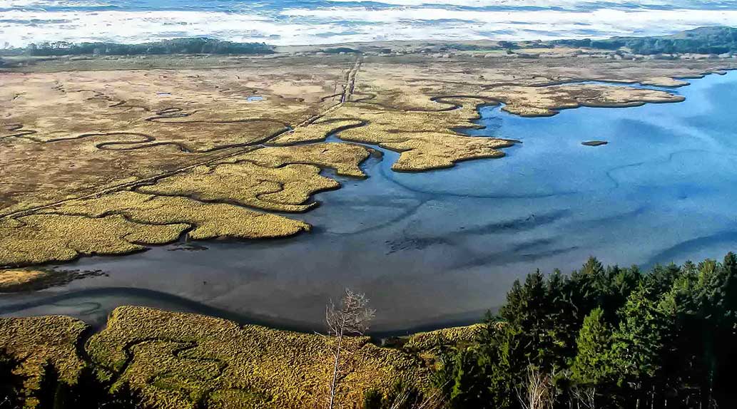
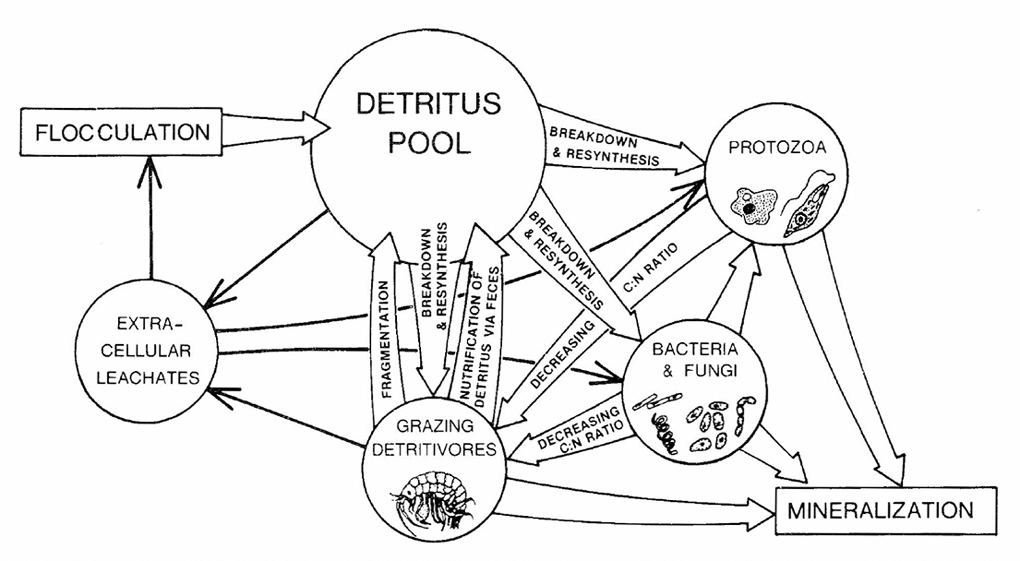
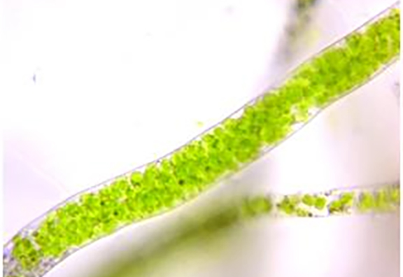
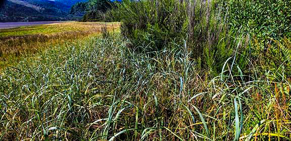
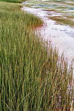
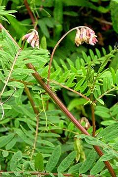
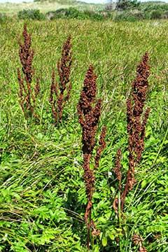
Channels, said Charles Simenstad, "form the estuary's circulatory system" (Simenstad, 1983).   They are the conduits that link marine and riverine ecosystems, and they play a major role in the production of fisheries and wildlife.  Unfortunately, this recognition is only recent.  In the past, estuaries and their channels were exploited for agriculture, industry, and colonization.  Many around the US and the world have been damaged or destroyed.  We are lucky that Netarts Bay, a bar built estuary covering almost 3.5 square miles, along  with its channels, remains mostly intact.

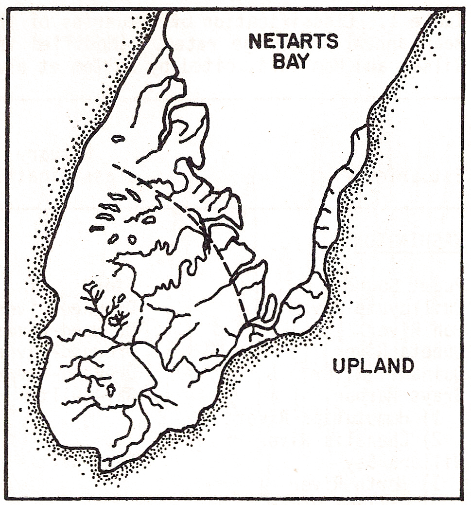
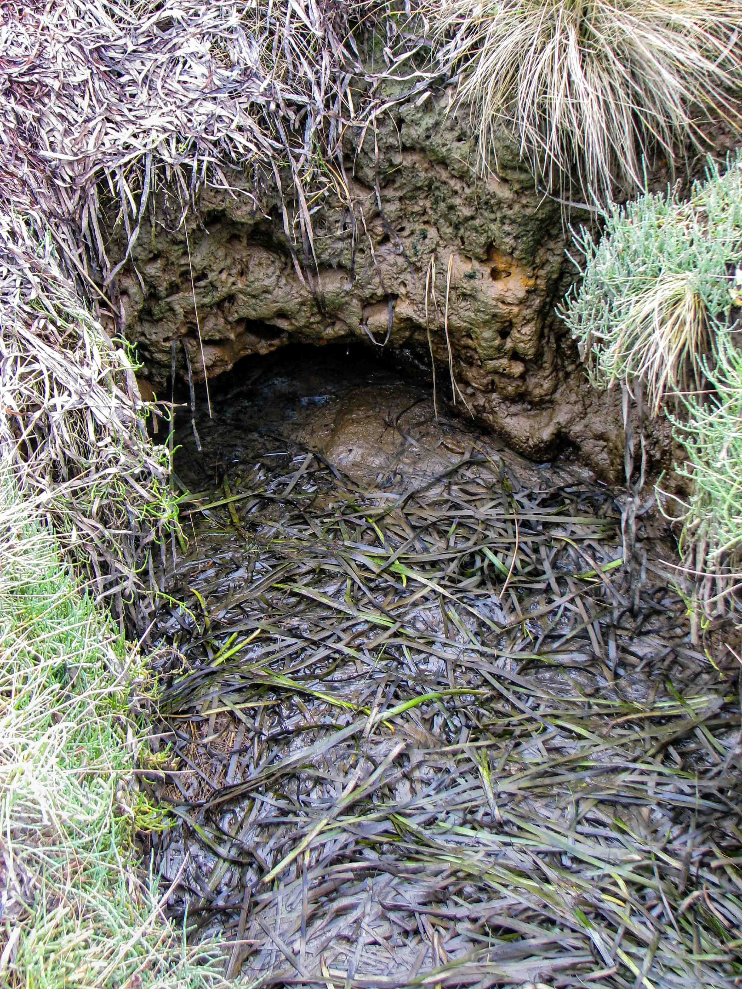
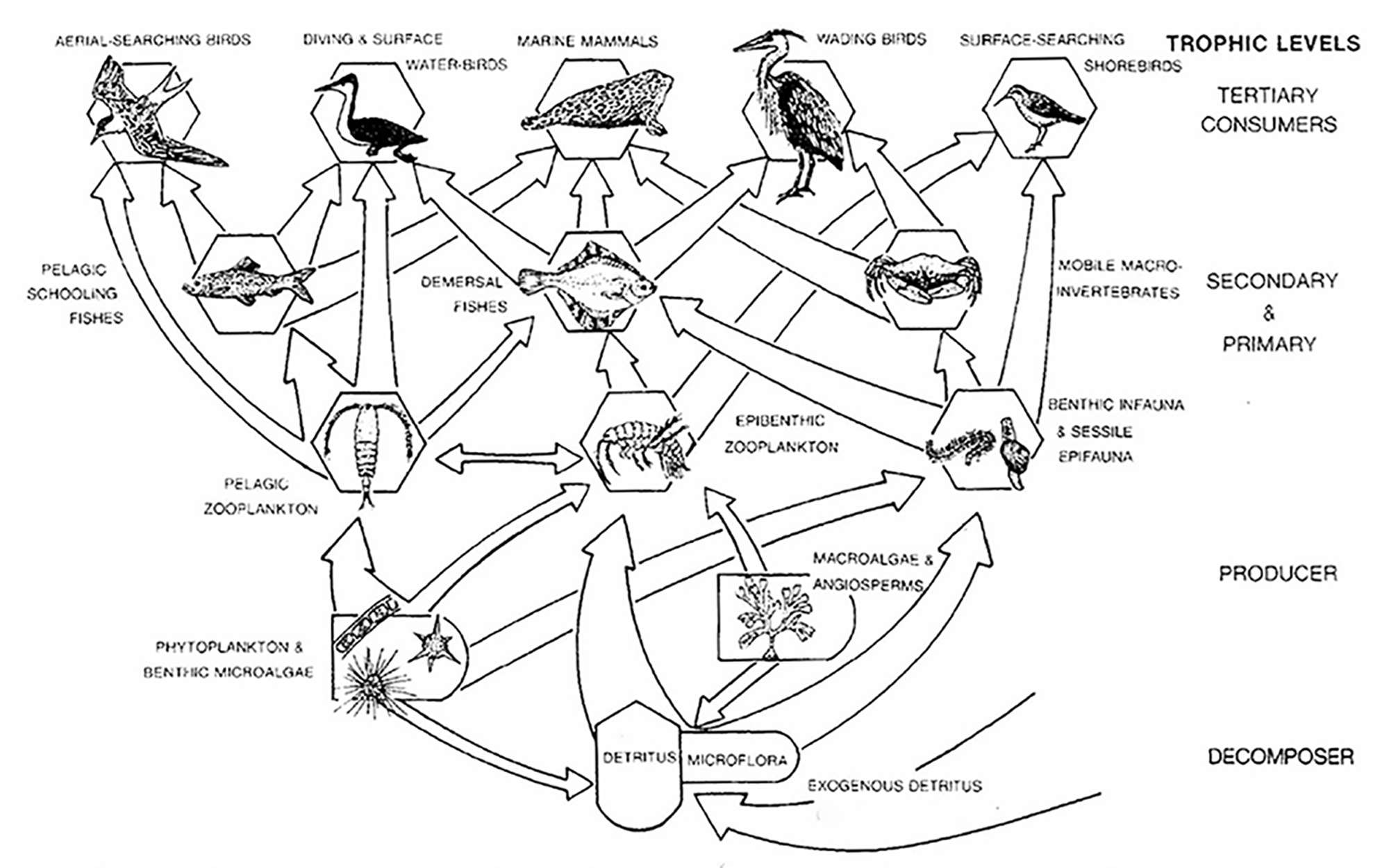
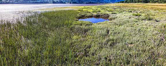
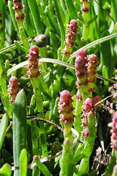
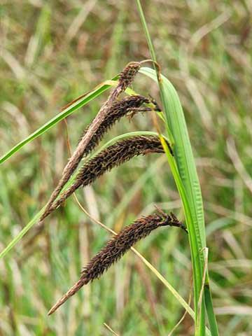
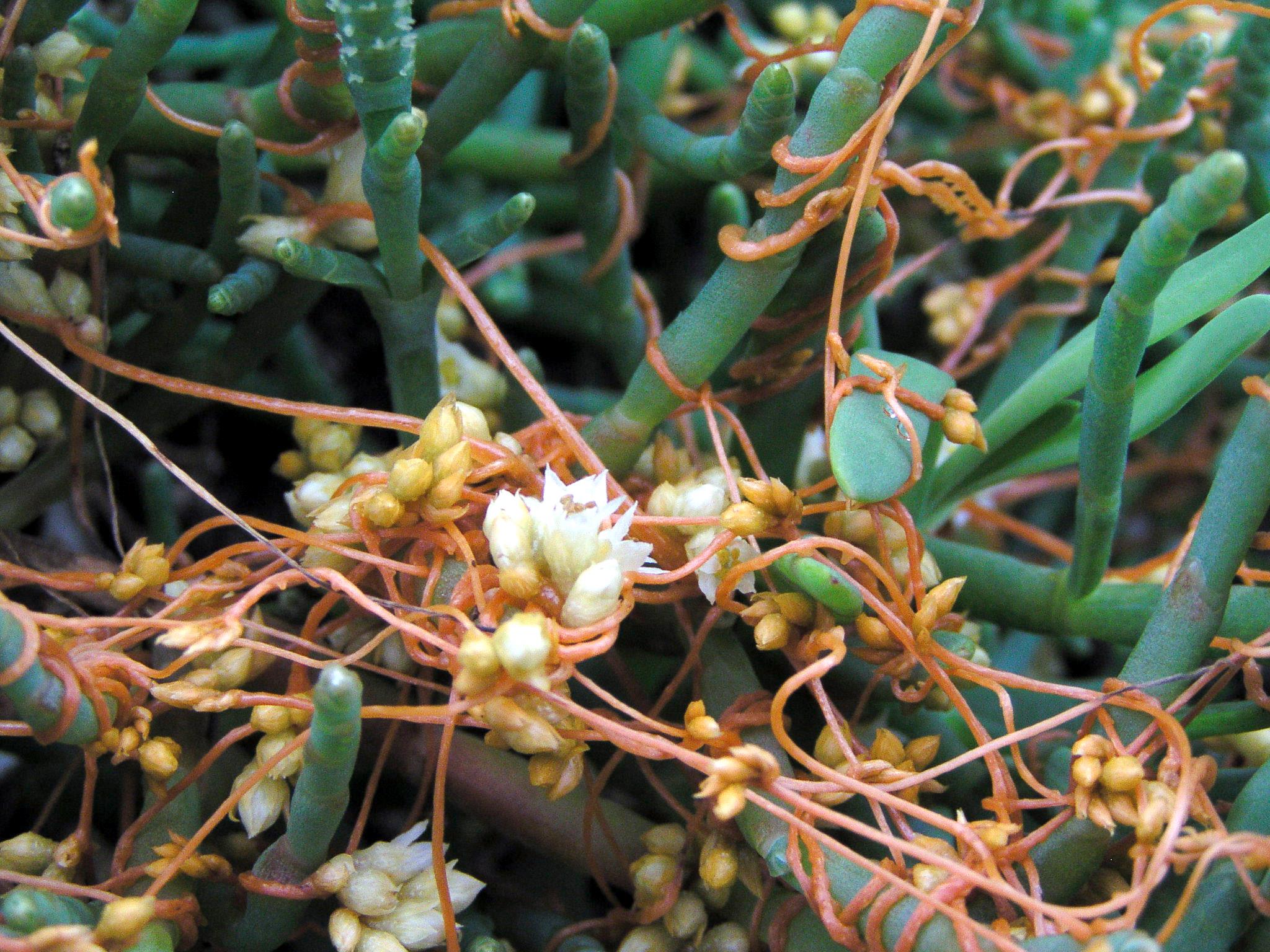
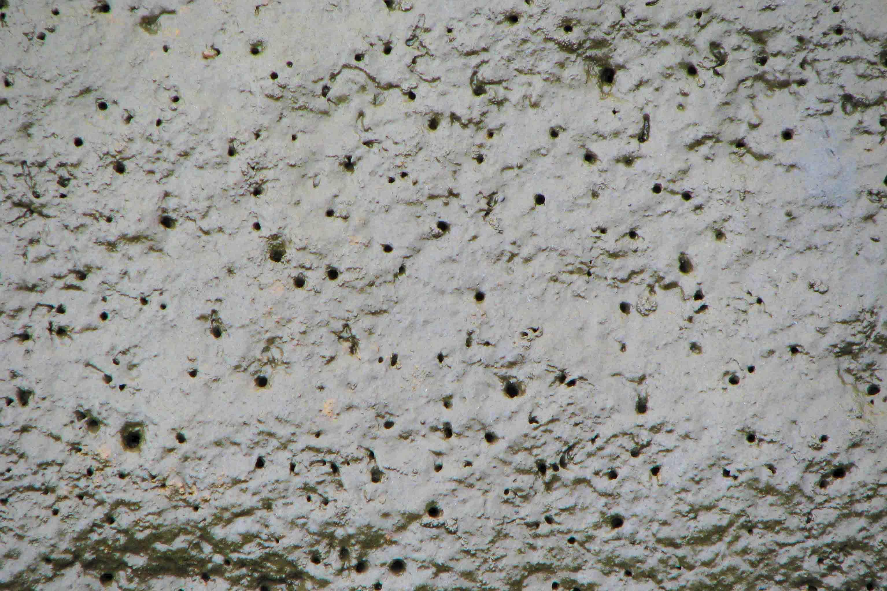
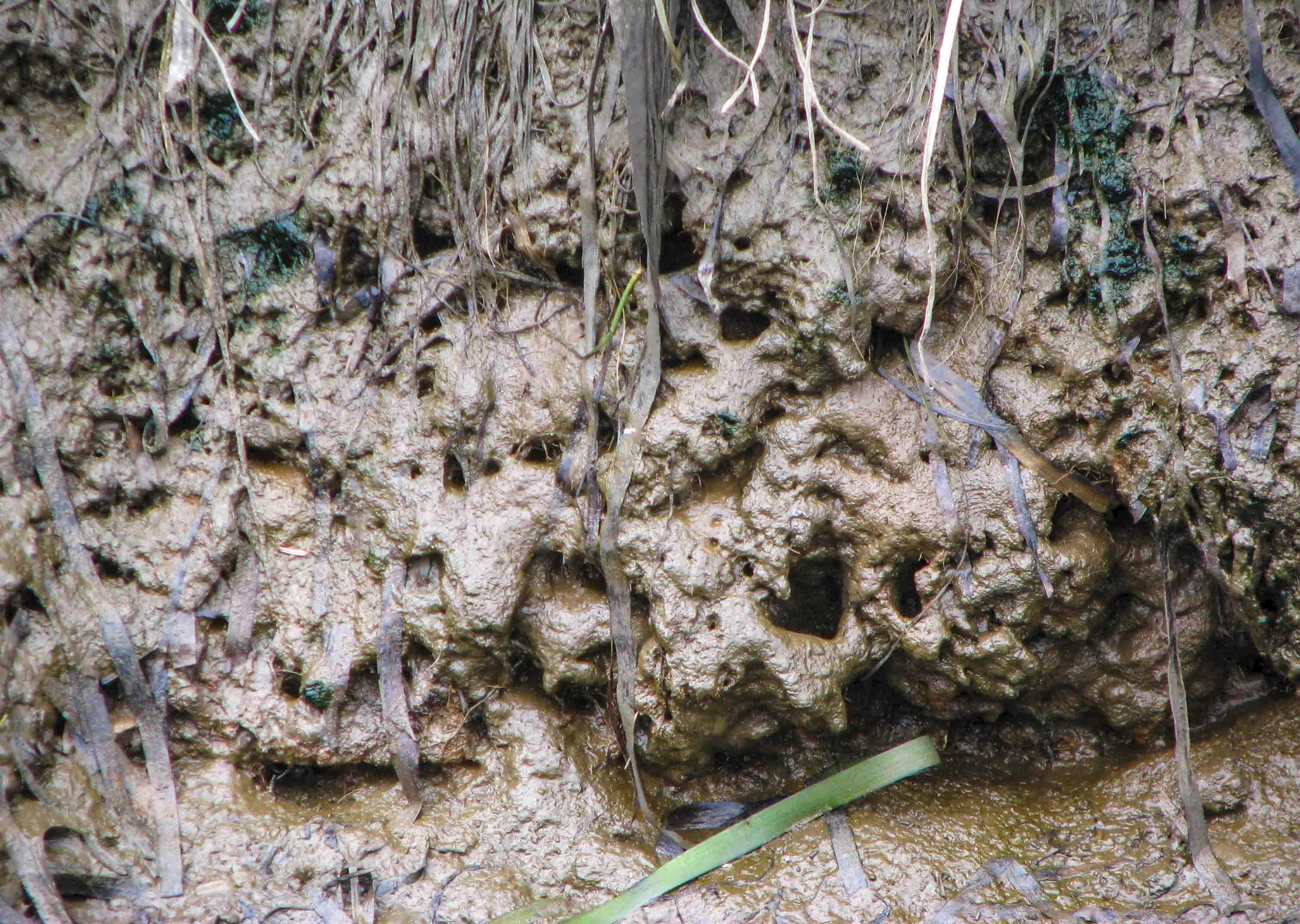
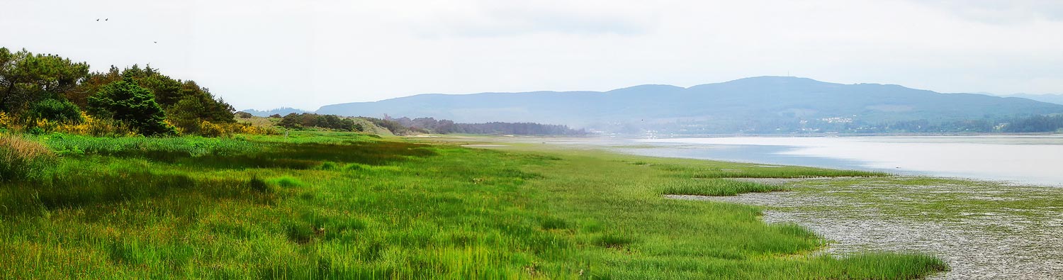
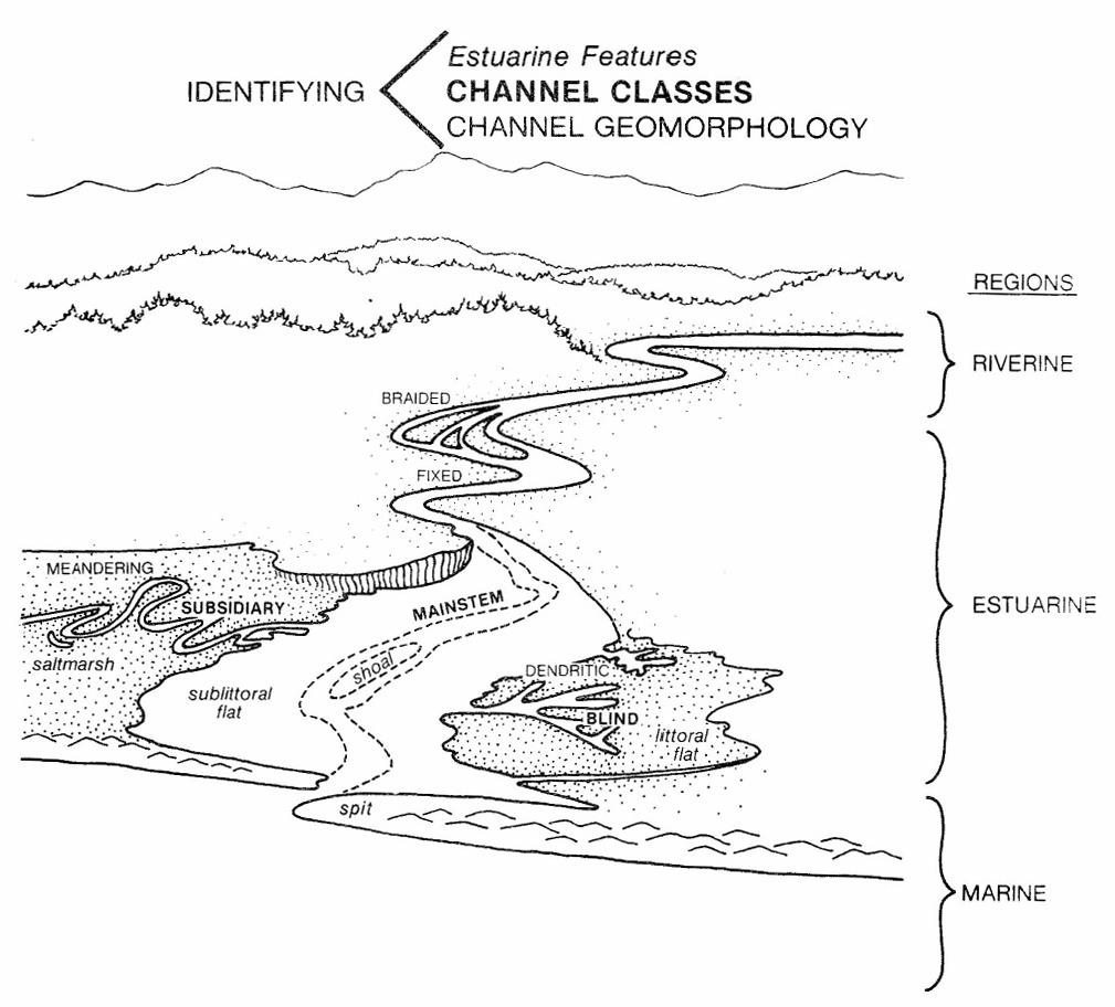
Above is a diagram from Simenstad, 1983, of representative estuarine components.  Although Netarts Bay has no river discharge of fresh water (Jackson Creek no longer flows into Netarts Bay), other features in the figure are similar to those evident in the photograph of the salt marsh at the beginning of this article.  You can see in this image of the south end of the bay, the mainstream channels, the adjacent littoral flat (there are few sublittoral flats in this shallow bay), meandering subsidiary channels, and blind dendritic channels within the salt marsh habitat.   In addition to this southern mature high marsh in the photo and the immature high and low sandy marshes along the west side of the bay that are mostly out of the photo, there are small pocket marshes with their own channels along Netarts Bay Road on the east side of the bay near the entrances of small freshwater streams.  Yeager Creek is an example.

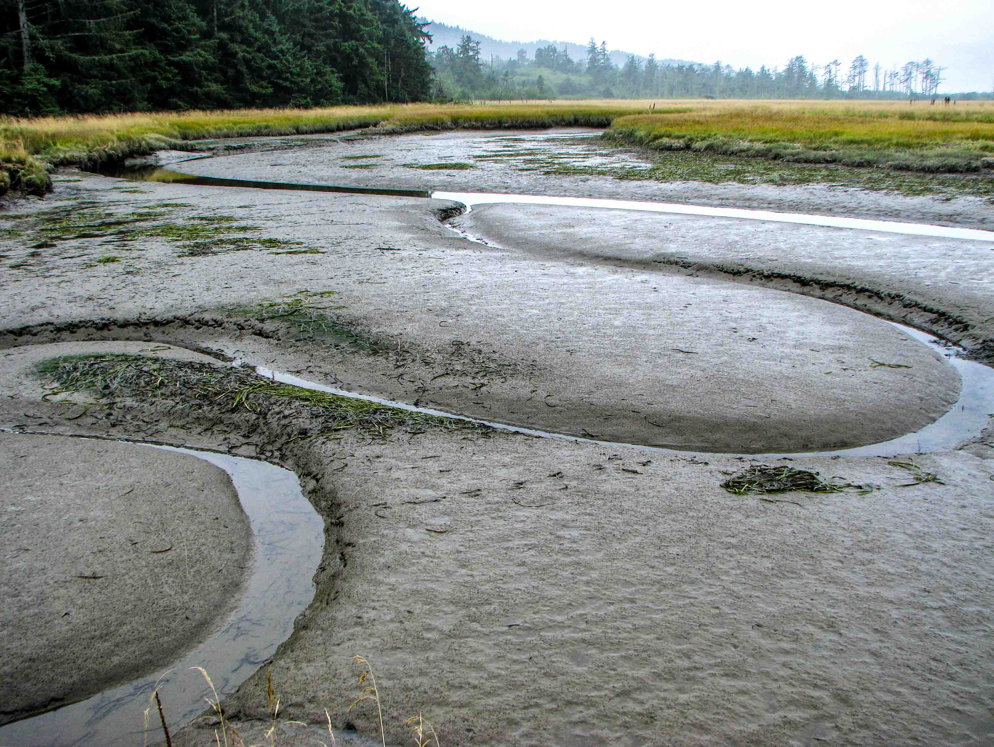
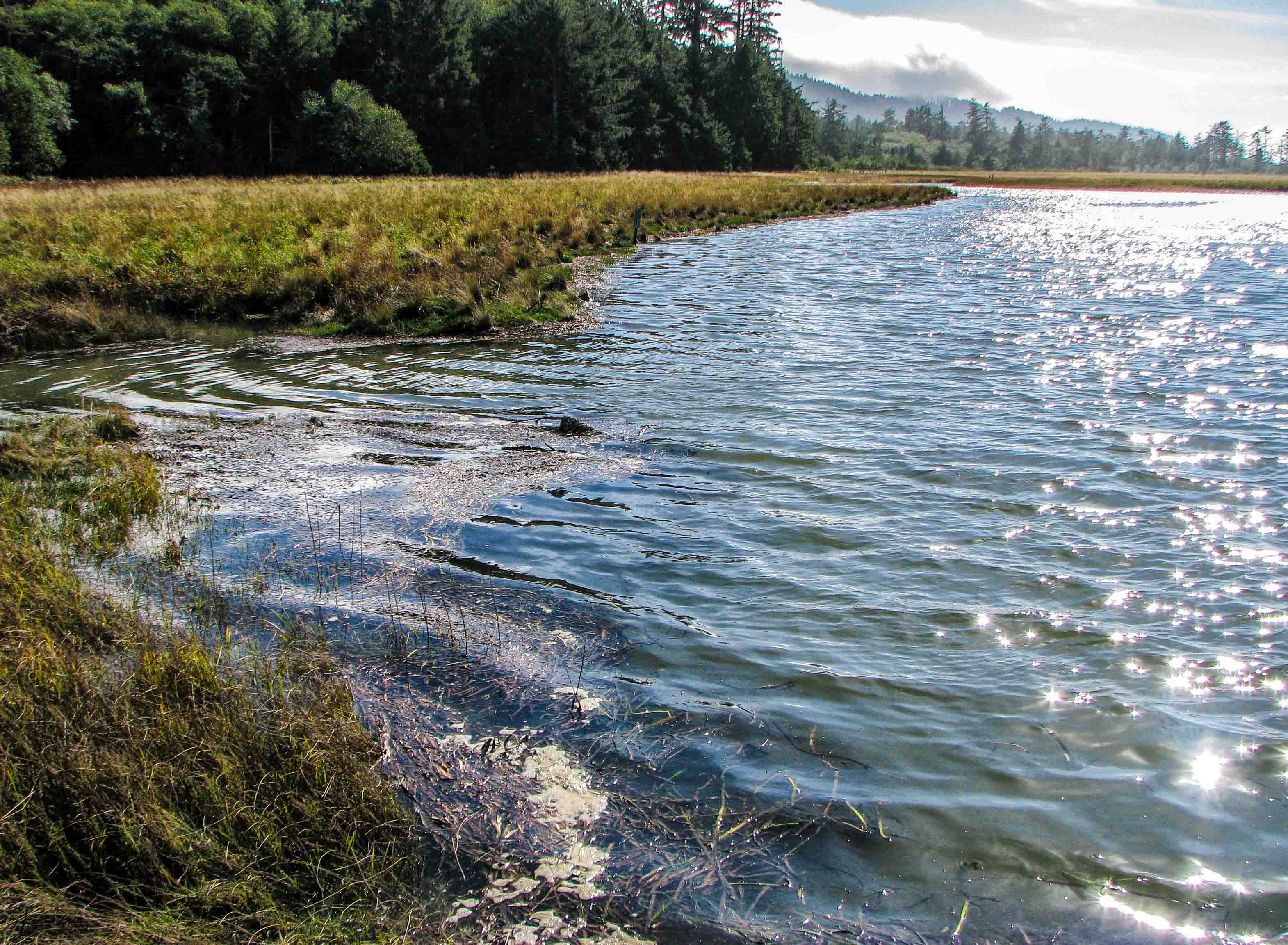
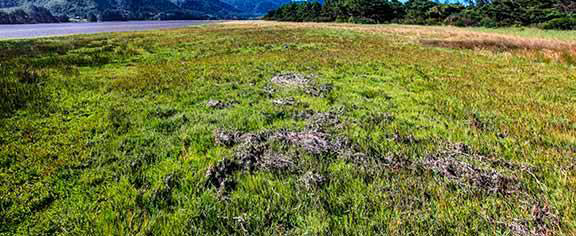
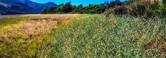
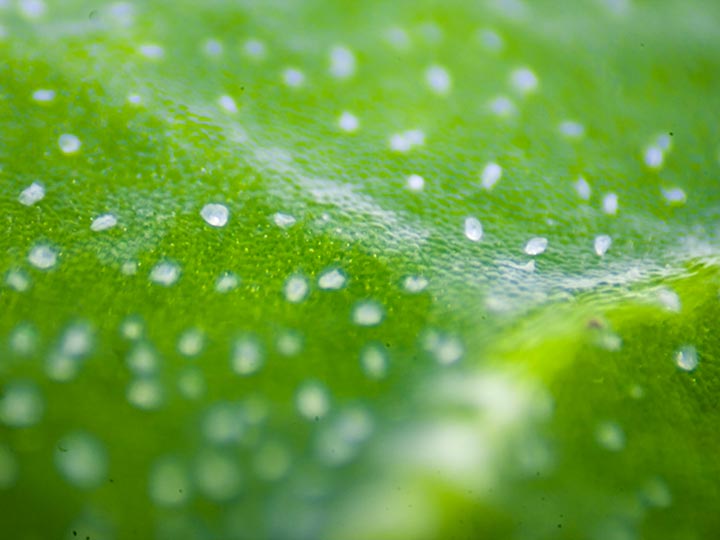
A typical channel cross section consist of a somewhat vertical bank, a slope, and a more-or-less level substrate.  Channels in Netarts Bay are either tidal where bay water flows in and out with the tides, or they are drainage channels that formed largely by freshwater runoff that cuts through soil substrates with low resistance or weakly stabilizing vegetation.  Tidal channels, including those that are mainstream, are fairly wide and deep and may not empty completely during low tides.  Drainage channels, such as blind dendritic and subsidiary channels, are usually higher in elevation, and often narrow down to a few inches across near their blind ends.  They flood with bay water only at the highest tides.  Some of these blind channel extend to the perimeter of the marsh and to the edge of the forest.  They may also tunnel under the marsh surface where overlying vegetation is thick and stable.  It has been noted in other marshes that even the smallest channels, some only a few inches wide and deep, can influence plant distributions (Sanderson et. al., 2000).

Most channels meander in a sinuous, snake-like pattern.  This meandering is the result of ebbs and floods of tidal waters that cause the slumping of channel banks, particularly during at ebb flows which, according to Fagherazzi  et. al., 2004, have water velocities stronger that those during flood flows, resulting in differential bank erosion.
Channels at low tide.

Channels at high tide.

Drainage channel tunneling under the marsh land.

Channel Soils
Soil in the salt marsh at the south end of the bay and its channels is classified in the jargon of soil science as a "fluvaquents-histosols complex" (USDA Web Soil Survey).  A fluvaquent is a kind of wet soil typical on river banks and tidal mudflats (an aquent) that is produced by frequent flooding, in the case of our marsh, at high tides.  A histosol soil is comprised of mainly organic materials.  Organic carbon, that carbon from decayed biological material, was analyzed in 1976 from numerous sites in the bay (Stout ed. 1976), but not from the marsh channels at the south end.  They found that mud flats on the east side of the bay contained high levels of organic carbon, to over 3.4%.  It is likely that the marsh channels  and their accompanying mud flats contain much more organic carbon because the slow water velocities allow fine sediments and plant debris to accumulate, and the sediment cores I examined contained lots of decayed vegetation and probably animal parts as well.  The grain sizes in the southern part of the bay classify the sediments generally as silty-sands, however the fine silt grains with their large surface areas that are found in the channels and littoral flats are typically associated with high levels of adsorbed organics (Stout ed. 1976), increasing the organic load. 

Those of you who have dug clams in the bay have undoubtedly encountered a layer of black, rotten-egg- smelling sediments somewhere under the surface, especially in muddy areas where there is little exchange of interstitial water in this soil with overlying waters.  This layer, common in the channels, is called the "sulfide layer", and is produced by sulfate-reducing bacteria, bacteria that thrive in an anaerobic (oxygen-free) environment and reduce sulfates to hydrogen sulfide (H2S), which is the chemical that makes the soil smell like rotten eggs.  Decaying organic matter in these sediments  consumes all the free oxygen, turning them anaerobic and allowing these bacteria to flourish.  The H2S combines with iron in the sediment to form iron sulfide and this turns anaerobic soil black.  If these black soils encounter oxygen, the iron sulfides then oxidize to iron oxides.  It is these iron oxides that can feed the bacteria that produce silvery surface films, which we discuss below.


Micrograph of cell walls of decayed plant from tidal channel.

Those Mysterious Silvery Films in Marshes
There is an interesting occurrence in wetlands, including the salt marshes of Netarts Bay, that you may have seen if you have ever ventured into a marsh.  It is a silvery, sometimes iridescent film that floats on the water's surface at marsh edges, in pools, and in seeps that looks for all intents and purposes like an oil slick.  And in a sense it probably is, but not from petroleum, though it is often mistaken by people for an oil spill.  It is a mixed organic and inorganic, non-petroleum sheen caused by bacteria breaking down organic matter from decaying plants and animals.  It is a very thin sheet, maybe 150 microns to 500 microns (1/2 millimeter), and an interesting indicator of wetland metabolism 

The film is often associated with rusty-looking wetland sediments, which you may find along some of the muddy shores and channels of Netarts Bay.  These sediments contain iron, and there are so-called "iron bacteria" living in the film that use the metal from these sediments as an energy source.  Depending on the kind of bacteria, the amount of organic material, and the amount of dissolved oxygen in the water, they may either reduce iron oxide in the sediment to ferrous hydroxide or convert the soluble ferrous metal into an oxide.  Dr. Randall W. Smith of Portland State University (Department of Physics), using special  techniques with electron microscopes, has determined the iron in the film is a complex of "mixed-valent"  (Fe2+ and Fe3+) reduced iron and iron oxides and may indicate an incomplete oxidation process.  Other metals such as manganese, nickel, and zinc may be involved as well.  Manganese especially is found in mixed valent states. The films are not amorphous but are nanocrystalline, formed of very small crystals. It may be that the ordered crystals begin to form in the mineral when it was in an amorphous state

How can you tell whether a film is a natural, metallic surface film or one from petroleum?  Poke it with a stick.  If the film breaks up into separate plates, it is a natural metallic surface film.  If it reforms into a single sheet and clings to the stick, it is a petroleum slick.  Bacteria play an important role in the formation of these films.

Non-petroleum surface film in the Netarts Bay salt marsh
Iron-containing sediment and surface films in a salt marsh channel in Netarts Bay.
Bacteria in an metal-containing surface film (scanning electron micrograph by Dr. Randall W. Smith)

Primary Production and Detritus - The Basis of the Salt Marsh Food Web
Any food web involves the transfer of energy, and for most life on earth that energy begins with the fixation of carbon by photosynthesis.*  That carbon provides energy for higher trophic (nutritional) levels.  Within the salt marsh estuary,  the primary producers - those organisms that photosynthesize - include benthic microflora (such as diatoms, cyanobacteria and other microalgae), seaweeds, phytoplankton, and sea grasses, especially eelgrass in Netarts Bay.   These photosynthetic organisms provide food directly when they are eaten, or indirectly when they die and decompose and contribute to organic detritus, "the dominant pathway of trophic carbon into estuarine food webs"  (Simenstad, 1983).  Another source of photosynthetic organic carbon are terrestrial marsh plants, such as those described above, and adjacent forest plants with leaves and wood that  wash into the marsh channels where they decay. 

What is detritus?  It has been defined as any biogenic material in various stages of microbial decomposition  that can be an energy source for consumer species.  This material can come from both plants and animals that have died, from feces of aquatic and terrestrial animals, from adsorbed organics on sediments, or even the residing bacteria and fungi that help decompose organisms.  Much of the carbon released from decomposition dissolves in the water and is referred to as DOC or dissolved organic carbon.  This DOC eventually aggregates into fine particulate organic carbon or FPOC through complex physical and chemical interactions, and it is FPOC that is a basic constituent of detritus.   These particles are suspended for a time, but tend to settle to the bottom of estuarine channels where the velocity of currents is low.

Microorganisms, such as bacteria, fungi, and protozoa, condition the detritus to make it more suitable for consumption.   For example, some bacteria and fungi can break down cellulose.  There is also physical and chemical conditioning that comes into play, such as weathering to break down cell walls of plants, or the chemical adjusting of carbon/nitrogen ratios, all making the detrital particles more nutritious.  The animals that feed on detritus are called detritivores, which include infauna (animals such as worms that live in the sediment) and epifauna (animals that live above the sediment).  The detritivores  become food for fish and crustaceans which, in turn, are food for birds and mammals.  The following illustrations are from Simenstad, 1983.

____________________

*Chemosynthesis, the synthesis of organic compounds for living organisms by energy derived from inorganic chemical reactions, is found in some deep-sea organisms, especially those near thermal vents.


Channel Life
Algal Mats

Along the edges of the channels you may often find a dark green growth on the surface of the mud.  This is an algal mat composed of a mixture of eukaryotic and prokaryotic algae.  Eukaryotes have cells with membrane-bound organelles, including a defined nucleus and chloroplasts.  Prokaryotes, on the other hand, lack membrane-bound organelles, thus lack both a defined nucleus and chloroplasts.  Microscopic examination is often necessary to diagnose or identify these organisms.* The eukaryote composing most of the mat, is probably a species of Vaucheria. The letters sp. that you see following a generic name, e.g., Vaucheria sp., means that the species of Vaucheria was not determined.   The prokaryotes pictured here are cyanobacteria (blue-green algae) that include species of Oscillatoria, Spirulina, and others.

Oscillatoria also occurs in pure mats along the bay's edge.  A good site to observe Oscillatoria is just south of Netarts Bay Drive and Whisky Creek Road.  Here it grows on a firm silt substrate just bayward of the terrestrial vegetation line. This blue-green alga (Oscillatoria) has a unique ability to oscillate and orient itself to receive maximum sunlight.


_____________________________

* A chemical test was also used to distinguish cyanobacteria from eukaryotic algae.  Cyanobacteria contain no starch: eukaryotic algae do.  Iodine turns starch a blue-black color.  Vaucheria turned color; cyanobacteria did not.
Algal mat - Green area
Oscillatoria sp.
Vaucheria sp.
Spirulina sp. (coiled) and others
Plants and Their Distribution Across the Marsh

The diagram and photos below represent an actual transect taken on July 22, 2015 across a narrow portion of the marsh adjacent to the dunes on Netarts Spit to illustrate this plant zonation from the saline bay edge, where the most salt-tolerant  plants thrive, to the edge of the dunes above any bay water inundation.  This was a 212-foot transect line starting at the boundary of the mudflat where Japanese eelgrass Zostera japonica gave way to three-square sedge Schoenoplectus americanus.  This point was designated zero inches elevation.  The plants recorded along the transect and to about 20 feet on each side of its line were the more dominant species that form what are known as zonal communities.
 
Communities 1 and 2 - three-square sedge (Schoenoplectus) is on the left.
Community 3 - dominated by Jaumea.
Communities 4 and 5 - dominated by tufted hair grass (Deschamsia), then native dune grass (Leymus).
Community 5 - entering dune habitat.


The first 20 feet of transect into the salt marsh, from 0 to 7 inches in elevation contained only three-square sedge.  A Salicornia, Distichlis, Triglochin, Jaumea community dominated the area 20 feet to 100 feet with an elevation change from 7 to 21 inches.  From 100 feet to 150 feet with an elevation change of 21 to 32 inches, Plantago maritima mostly replaced Triglochin.  Between 150 and 190 feet with only an additional 10 inches of elevation, the number of plant species began to increase, and Carex obnupta, Juncus, Grindelia, and Deschampsia were added.  From 190 feet to 210 feet, the elevation increased dramatically from 42 inches to 76 inches and the transect entered the dunes.  This plant zonation is akin to that found in the more familiar rocky intertidal habitat.  It is not quite as obvious because vertical slope is much less abrupt.
 

The photos below represent the plants listed in the table next to the graph and found along the transect.
Angelica lucida
Sea Watch
Deschamsia crespitosa
Tufted Hairgrass
Jaumea carnosa
Jaumea
Pteridium aquilinium
Bracken Fern
Argentina (Potentilla) anserina
Pacific Silverweed
Distichlis spicata
Saltgrass
Lathyrus palustris
Marsh Pea
Schoenoplectus americanus
Three-square Sedge
Atriplex patula
Orache
Gallium aparine
Cleavers
Lonicera involucrata
Twin Berry
Salicornia virginica
Pickle Weed
Carex obnupta
Slough Sedge
Grindelia integrifolia
Gumweed
Oenanthe sarmentosa
Pacific Water Parsley
Triglochin martimum
Arrow Grass
Cytisus scoparius
Scotch Broom
Hordeum jubatum ssp. jubatum
Foxtail Barley
Plantago maritima ssp. juncoides
Seaside Plantain
Zostera japonica
Japanese Eelgrass

Leymus mollis
Native Dune Grass
Juncus balticus
Baltic Rush
Polystichum munitum
Sword Fern
Vicia gigantea
Giant Vetch
The salt marsh of Netarts Bay is divided into several different types designated by plant species as they are adapted to substrate, salinity, and elevation (Stout ed., 1976; Seliskar and Gallagher, 1983; U. S. Army Corps of Engineers, 1981). The southern end of the bay pictured above is considered a mature high marsh with level, peaty soils and a dendritic network of channels.  Along the western sides of the bay are immature high marshes, relatively level with silty substrates, and  low sandy marshes on sandy substrates with gradual slopes.  The edge of the bay where the three-square sedge grows is a sedge marsh, which is usually flooded at high tides.   See Seliskar and Gallagher (1983) for more comprehensive explanations.  The transect ranged from a sedge marsh to what is probably an immature high marsh bordering on a mature high marsh.

Most plants are seasonal, some making their appearance before or after others.  Below are photos of plants found in the Netarts Bay salt marsh, but not along the transect, because they either bloom at a different time or were in another part of the marsh or type of marsh.
Bolboschoenus maritimus ssp. paludosus
Salt marsh bullrush

This is a native found in coastal and inland salt marshes, particularly in the West and Midwest.  This genus along with Schoenoplectus and a couple of other genera was grouped under the single genus, Scirpus, and this is how it appears in the older literature.  I found it in patches living in depressions, ponds during winter, near the old dike in the mature high marsh.  The "ssp." means subspecies.

Cordylanthus maritimus ssp. palustris
Salt-marsh bird’s-beak

A member of the snapdragon family (Scrophulariaceae), this plant is rare in northern Oregon.  Here, it occurs only in one place in the immature high marsh on the west side of the bay in a strip about 300 yards long and 30 to 40 yards wide, mostly as scattered plants, but one  area of maybe 100 square yards where they are fairly dense.
Carex macrocephala
Big headed sedge

This sedge is typical of the sand marshes along the western perimeter of the bay.  Double click here for more information on this plant under greenish flowers in the wildflower section.

Rumex aquaticus var. fenestratus (formerly R. occidentalis)
Western dock

Western dock usually blooms in May and June, and by mid-July is often dried out, as those are picture here.  It is common at in wet habitats, especially along the upper margins of mature and immature salt marshes.

Castilleja ambigua ssp. ambigua
Johnny-nip, paintbrush owl's-clover

Johnny-nips appear in midsummer in the immature high marsh and may blanket an area giving it a snowed-on look.  Click here for more information on Johnny-nips. 
Scirpus microcarpus
Small-fruited bullrush

This is a tall, large-leafed sedge common to wetlands, and is locally found in a large patch on the eastern side of the Netarts Bay salt marsh, just inside of the Cape Lookout State Park boundary.
Armeria maritima, ssp. californica
Sea pink, sea thrift

Sea pink is another sand marsh inhabitant that typically blooms in July.  Click here for more information.

Cuscuta salina var. major
Salt marsh dodder

Salt marsh dodder is parasitic on Salicornia virginica.  You can see its web of thin, orange stems winding and encircling pickleweed during the summer months.  The "var." means variety.

Atriplex gmelinii
Gmelin’s orache

This west coast saltbush in Oregon is found only in Tillamook, Lincoln, and Lane counties.

Salt Regulation in Marsh Plants
Plants that can tolerate salt are called halophytes, and most plants living in a salt marsh have some mechanism for either avoiding salt or for regulating the salt content within their tissues.  As a first defense, the roots of many plants will exclude salt as they absorb water and nutrients.  In addition, plants like salt grass,  Distichlis spicata, have groups of specialized cells in their leaves called salt glands that collect salt and excrete it as a concentrated brine through pores in the cuticle.  Others, such as orache, Atriplex patula, have salt bladders which are modified epidermal hairs that collect salt into bladder cells that finally swell and burst to discharge salt onto the leaf’s surface.  Succulent plants contain certain cell in leaves enlarge and store salt before it is released.

Salt brine being secreted by salt glands onto a leaf of Distichlis spicata.
Salt crystals a on a leaf of Distichlis spicata after water in the brine has evaporated.
Salt crystals from salt bladders on the underside of a leaf from Orache (Atriplex patula).

Some Animals of the Salt Marsh
Invertebrates

A fine-mesh plankton net dragged along the surface of the mud in the mainstream channels captured some prevalent epibenthic crustaceans, one of which is the blacktail bay shrimp Crangon nigricauda.  The common name (and the specific name) of C. nigricauda is misleading in that this shrimp does not always have a black tail.  It feeds on amphipods and is eaten by Dungeness crabs.  The net also captured some gammaridean amphipods.   The amphipod on the left is in the family Aoridae, probably Paramicrodeutopus schmitti, a tube-dwelling family common in estuaries.  The amphipod on the right is Grandidierella japonica is an invasive species from Japan that may compete with our native amphipods.
Crangon nigricauda
Paramicrodeutopus schmitti
Grandidierella japonica
At the base of the banks of the mainstream channel and extending out into the littoral mud flats are a myriad of small holes a few millimeters in diameter.  These house a small nereid polychaete worm, generally less than two inches long, probably Nereis latescens.
Nereis holes
Nereis latescens
The vertical banks of the channels are fenestrated with holes about a half inch to a couple of inches across.  These are the burrows of the green shore crab Hemigrapsus oregonensis, also called the Oregon shore crab or the mud-flat crab.  This crab is found in quiet waters all along the Pacific coast.  It is a vegetarian, feeding mostly on green algae and diatoms.  It can tolerate the fine sediments in these muddy burrows because a mat of bristle-like setae at the openings to their bronchial chambers, which contain their gills, block the entrance of mud grains.
Hemigrapsis burrows
Oregon shore crab Hemigrapsus oregonensis
Netarts Bay Today is Sponsored by

Click on Logo to return to NetartsBayWEBS.org

P.O. Box 152
Netarts, OR, 97143