Waves
“White horses are calling me
to ride on the tide to the wide open sea
spurred by the wind, tamed by the moon
I will ride the white horses soon.”

- Brian Bedford, song writer
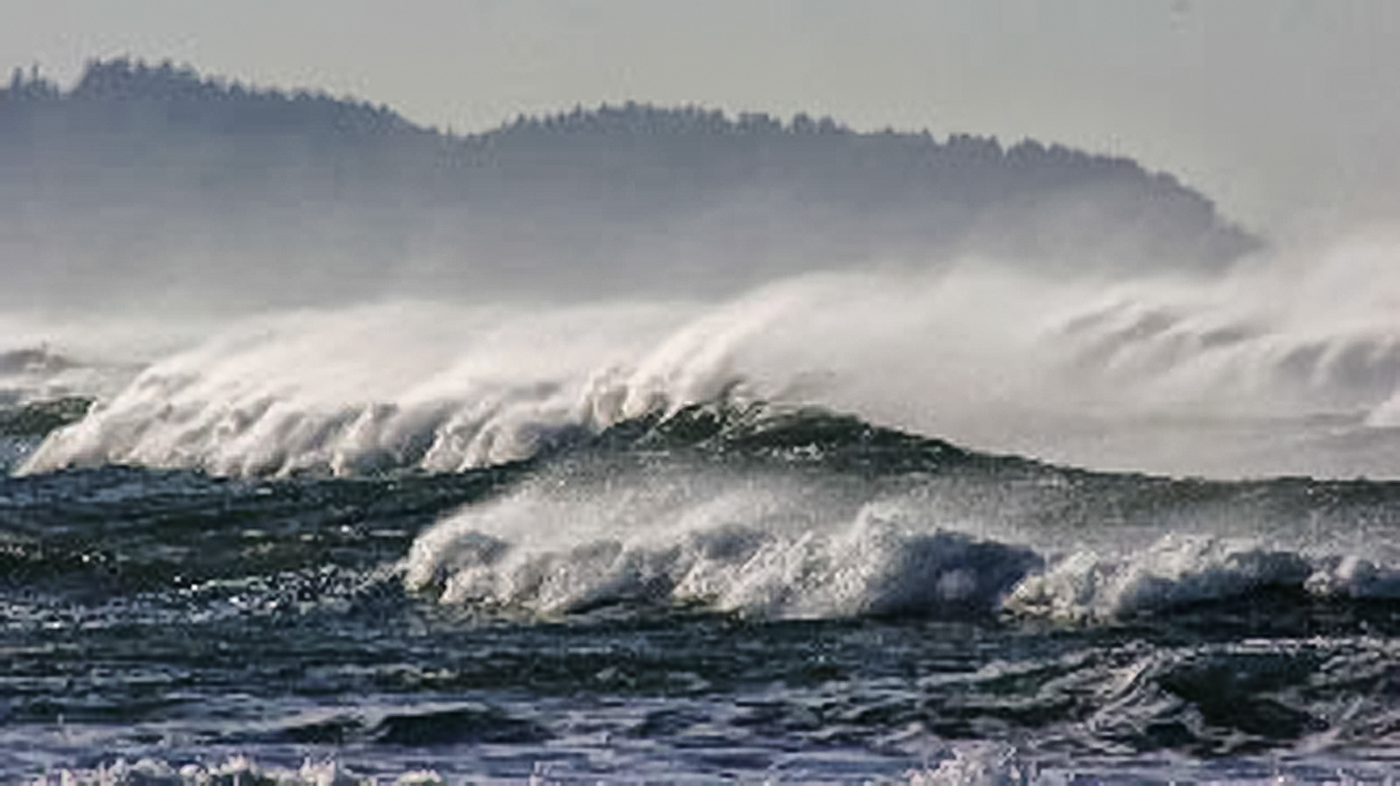
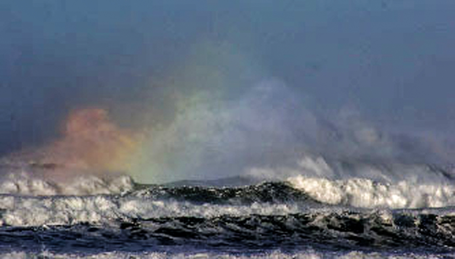
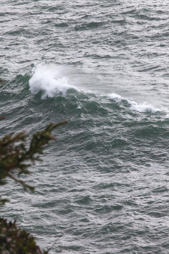
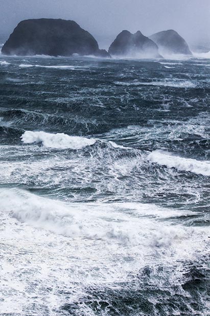
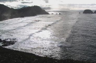
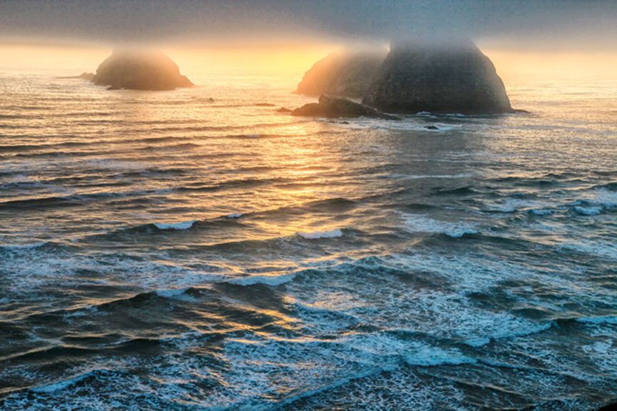
Winter storms on the Oregon Coast draw a special breed of tourist, the Storm Watchers. They come here just to see the drama and violence of hurricane-force winds and some of the world’s wildest surf - massive breakers,  Brian Bedford’s White Horses, galloping toward shore, trailing manes of white, wind-blown froth from their heads as they pound beaches and rocks, sending spray high into the air.  Sunlight refracting through their mist gives them the colors of rainbows.

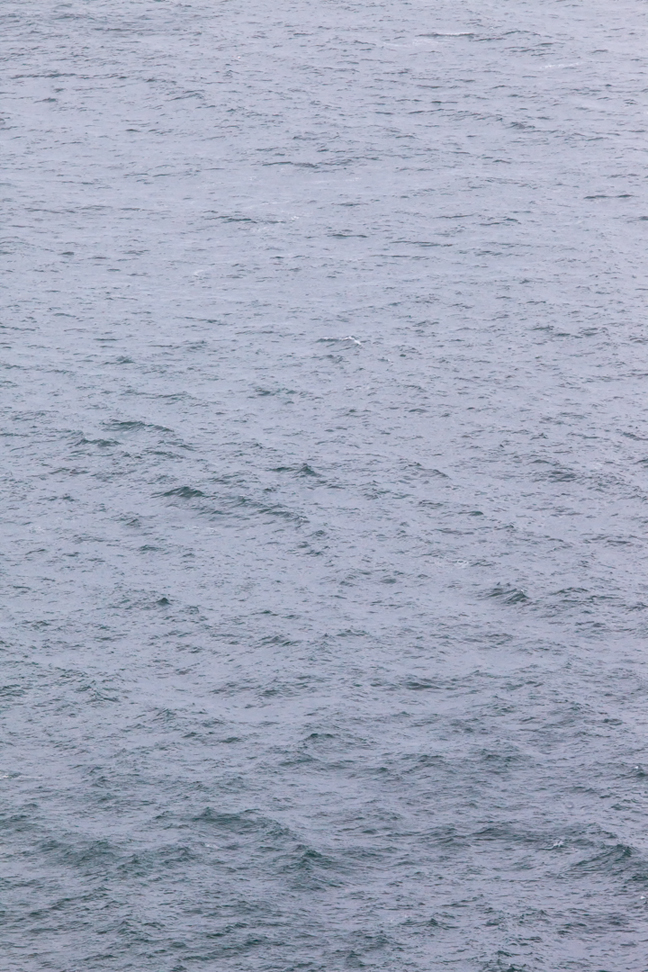
As Brian Bedford indicated, waves are generated by the wind - at least most are - and it is during winter storms when they are most spectacular.  The other kind of wave we might see, or rather we hope not to see, here on the Oregon coast is the tsunami, caused by earthquakes, volcanoes, or underwater landslides.  However, when we stand on the beach and look at the surf and the ocean just beyond, we can see two basic kinds of waves - those produced by local winds, (chop and whitecaps are examples) and swells from winds that are far away.

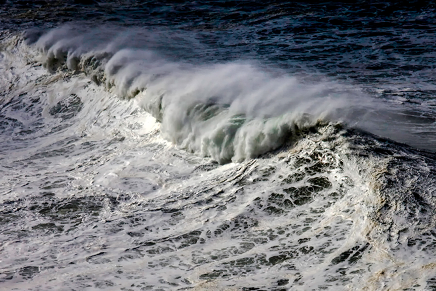
Physicist James S. Trefil (1984) notes, “A wave is a strange thing.” It appears to be water moving in a particular direction, but it’s not.  The water itself does not move, except in an orbital motion as the wave passes, and does not travel with the wave.  If you could look at an ideal wave (not in a breaker, but in a wave beyond the breakers) in cross section and follow particular chunk of water, you would see it rise with the wave, move forward as it is rising, then move downward as the wave begins to pass, and finally move backward and upward to its original position, traversing a circular path.  You can see this easily if you toss a rock into a still pond near a floating stick. The stick will bob in an orbital motion, but will not travel with the waves that pass it.  The amount of orbital motion is greatest at the top of a wave and decreases to about zero at a depth that is equal to one half its wavelength, at least in deep water.  Ok, here are some terms we need to know.  The wavelength is the horizontal distance from the crest of one wave to the crest of the next wave.  The height of a wave is the vertical distance from its crest to its trough.  The period of a wave is the time between wave crests.  The speed of a wave is its wavelength divided by its period

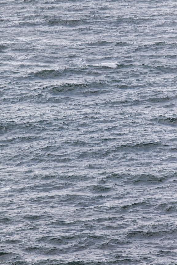
Let’s get back to ocean waves, beginning with those caused by local winds, wherever “local” may be, either here on the coast or far out at sea.  As the wind blows over the ocean, the pressure of the moving air deforms its surface, creating initially ripples (called capillary waves by oceanographers), then as the wind speed increases, larger waves.  Waves also depend on the wind’s fetch, that is, how far it blows, and for how long.  The faster, farther, and longer the wind blows, the bigger the waves.  Waves generated by local winds are chaotic and move in all sorts of directions.  They form what we commonly call chop, and we speak of this roughness as sea.  Marine weather reports might describe the sea as a four-foot sea, a six-foot sea, and so forth.  If the waves are steep enough, they break and we get whitecaps.  When the wind blowing at a given speed has a long enough fetch and blows for a long enough time, the sea reaches its maximum roughness, beyond which it cannot get any rougher at that wind speed.  This is called a fully developed sea.  For example, a sea becomes fully developed during a 25 mph wind after it has blown over a distance of 109 miles for 11.5 hours (Thurman 1991).
White horse waves withm their flowing manes
Photograph by Christopher A. Young


Rainbow spray
Photograph by Christopher A. Young


Sponsored by the Friends of Netarts Bay Watershed, Estuary, Beach and Sea (WEBS)
Capillary and small waves
Chop
White caps
Fully developed sea at Cape Meares - 80+ mph winds
Swells that hit our coast come from storms far out in the Pacific, sometimes hundreds or even thousands of miles away.  The chaotic waves in fully developed sea with a long fetch will start to order themselves as they move toward the edge of a storm where winds are less intense.  As they pass out of the storm, they organize into long rolling waves, swells that can travel great distances.  In the open ocean, swells may have long wavelengths and short heights, maybe a couple of feet, hardly noticeable.  But as they approach shore and the ocean becomes shallow, the swells encounter friction with the bottom which distorts and flattens the circular motion of water at the base of the wave.  Their speed slows, their wavelength decreases, and they become higher.  Swells approaching the coast at an angle will straighten themselves to come in parallel to the shoreline because the end of the wave hitting shallow water first slows and allows the rest of the wave to catch up.
Swells near Cape Meares
A breaker
Crossing waves
A breaker forms when a wave approaching shore becomes so high relative to its wavelength that it becomes unstable.  The bottom part of the wave is slowed, and, in a sense, the top part begins to outrun the bottom part.  At a critical steepness, the crest breaks, plunging or cascading down the shore side of the wave.  Larger waves, because of their interaction with the bottom in deeper water, will break farther from shore than smaller waves which only begin to crest in shallower water.  Breakers may come from either, or more likely both, locally generated waves or from swells created at sea.  This makes for interesting disorder in breakers - no two are the same.  They may combine and reinforce each other, or they may cancel each other.  In the picture on the right, waves and breakers near Three Arch Rocks are coming to shore at different angles.  When two crests meet in such a situation, they can build on each other (in scientific lingo, this is wave interference and the waves are in phase).  If a trough meets a crest, resulting wave will be diminished (the two original waves are out of phase).  Waves usually come from many directions and interact in an infinite number of ways.  Bottom contours will also affect breaker patterns.  An offshore shoal may cause a wave to break; then as the wave moves into deeper water closer to shore, it will reform, sometimes as several waves, to break again as they near the beach.  This situation can be seen near the mouth of Netarts Bay.
Sneaker waves can be a serious threat to beach walkers, especially children.  They are sneaky and can catch unaware people, knock them off there feet, drench them, and if the backwash is strong enough, pull them into the surf.  If a person walking a narrow beach at high tide is caught by a sneaker wave, he may not have room to escape.  Sneaker waves happen, according to Komar (1998), when long period waves - that is faster and more energetic waves - overtake slower waves, capture their energy, and run high onto the beach.  These waves are not predictable.  They do not come with every seventh wave.  Sneaker waves can happen anytime, in bad or good weather.  They are particularly dangerous during winter when the higher of the high tides occurs during the daytime when people typically walk the beach (see the section on tides), and seas are generally rougher.  Never turn your back on the surf, and stay away from floating logs and debris.  Keep your ears alert as well as your eyes.  If the surf suddenly becomes silent, beware!  The sound from waves is caused by the turbulence of the breaking wave front.  Turbulence, however, saps the wave’s energy, slowing it and not allowing the wave to reach high on shore.  The turbulence may be increased by backwash of a preceding wave colliding with an incoming wave and further slowing it.  But a sneaker wave often has a smooth wave front with little noise, and it retains its energy, gliding silently high onto the beach to catch a beach waker before he know it.

Tsunamis are the most serious threat to our coast.  The December 26, 2004 earthquake and a devastating tsunami in the Indian Ocean and the Tohoku earthquake and tsunami in March 2011 off Japan awakened us to the vulnerability of the Pacific Northwest coastline to a similar catastrophe.  Oregon sits next to an active subduction zone created by the Juan de Fuca and Gorda tectonic plates.  Sediment profiles taken from Netarts Bay and other areas indicate at least six high magnitude earthquakes with accompanying tsunamis occurred in the last 7000 years at intervals of 300 to 600 years (Komar 1998).  The last major subduction quake, deduced from Japanese records and estimated at a magnitude of nine, was on the night of January 26, 1700, over three hundred years ago.  The tsunami it generated reached the coast in 15 to 30 minutes, wiping out shoreline Indian villages from California to Canada, probably including one on Netarts Spit.  We are due for another one.  Today we have established siren warnings, emergency reverse 911 calls, and evacuation routes in case of an earthquake.  Information brochures and maps that identify tsunami hazard zones, evacuation routes, assembly areas, and what to do in case of an earthquake are available at the Netarts/Oceanside Fire Department in Netarts.  If you feel an earthquake, head for high ground to at least 100 feet above sea level, and remember that a tsunami is not just one wave but a series of waves that may continue for a couple of hours.
Netarts Bay Today is Sponsored by

Click on Logo to return to NetartsBayWEBS.org

P.O. Box 152
Netarts, OR, 97143